Catalog Archive
Auction 142, Lot 174

The Most Accurate Chart of Delaware Bay in the 18th Century

"Baye de la Delaware avec les Ports, Sondes, Dangers, Bancs &c. depuis les Caps Jusqu'a Philadelphie…", Le Rouge, George Louis

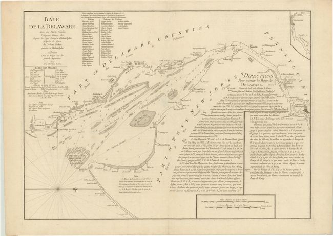
Subject: Delaware Bay

Period: 1777 (dated)

Publication:

Color: Black & White

Size:
25.8 x 19 inches
65.5 x 48.3 cm
Download High Resolution Image
(or just click on image to launch the Zoom viewer)

French derivative of the important Revolutionary War chart by Joshua Fisher. This plan of the bay and river was originally published in 1775 to assist pilots in bringing ships into Philadelphia, and was considered one of the most accurate and detailed of its time. The map is filled with sailing instructions, soundings and notes on hazards. A small inset at top right continues the navigation just past Philadelphia. A list of subscribers is adjacent to the title, complete with 22 pilots and 22 masters of vessels who believe the chart would help 'safe navigation' in the bay. A tide table is located just below the title. This uncommon and accurate map, published by le Rouge, was intended for use by the French military, merchants, and politicians.

References: Phillips (A) #1210-9; Sellers and Van Ee #1358.

Condition: B+

A dark impression on thick hand laid paper with watermark. There is minor damage at middle of centerfold from backstrap removal with old repair on verso. No loss to printed area, otherwise very good.

Estimate: $2,000 - $2,400

Sold for: $1,200

Closed on 11/28/2012

Archived