Catalog Archive
Auction 142, Lot 101

"L'Amerique Septentrionale", Ogier, Mathieu

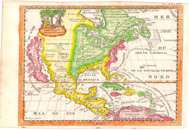
Subject: North America

Period: 1702 (circa)

Publication:

Color: Hand Color

Size:
7.5 x 5.5 inches
19.1 x 14 cm
Download High Resolution Image
(or just click on image to launch the Zoom viewer)

This scarce, charming map is very similar to the De la Feuille map of the same title (McLaughlin #147). It features a huge island of California with an indented coastline on the Fox model and the place names R. d' Estiete, C. Blanco, P. de Carinda, Canal de S. Barbe, I. de S. Martin, I. de S. Marc, B. de S. Francisco, B. de Simon, B.S. Christoue and Bernabe. The Rio Grande (Rio Bravo ou de Nort) is shown quite correctly for the period with its source in the mountains north of Santa Fe. The map is divided into French, British and Spanish colonial possessions. The map is decorated with a lovely little figural cartouche, and a ghost of a previously engraved adornment can be seen in the lower left part of the map.

References: McLaughlin #150.

Condition: B+

Issued folding, now pressed with narrow, but adequate, top and bottom blank margins.

Estimate: $450 - $600

Sold for: $325

Closed on 11/28/2012

Archived