Catalog Archive
Auction 141, Lot 545

"[Lot of 2] Macedonia, Epirus et Achaia [and] Morea olim Peloponnesus", Blaeu, Willem
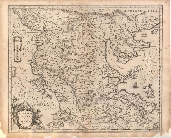
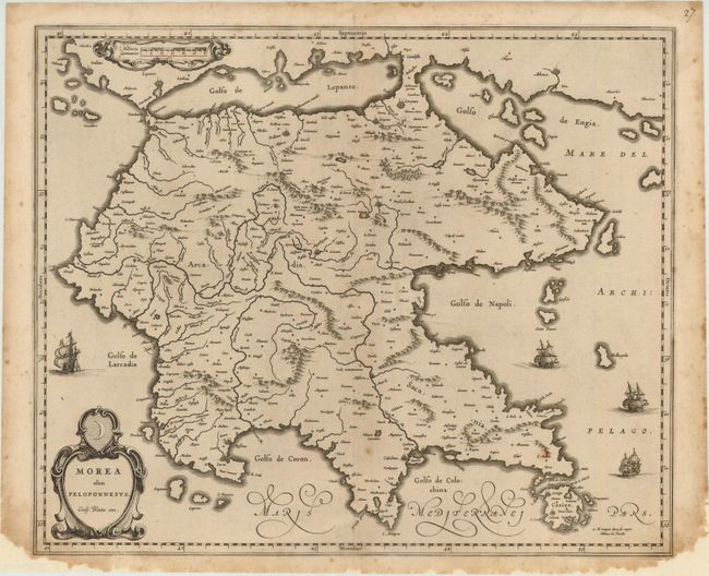
Subject: Greece

Period: 1680 (circa)

Publication:

Color: Black & White

Size:
19.5 x 16 inches
49.5 x 40.6 cm
Download High Resolution Image
(or just click on image to launch the Zoom viewer)

This pair of maps shows all of Greece. There is no text on back indicating these maps were issued after the demise of the great Blaeu publishing empire, as these were among the plates auctioned in 1677 following the fire that destroyed the printing house. Size varies slightly.

A. Macedonia, Epirus et Achaia. A well-engraved map that covers northern Greece to the Gulf of Cataro, including the island of Corfu, and extending to Macedonia and Albania. The cartography is based on Mercator's earlier map. The title is enclosed within a decorative cartouche attended by a leering satyr and an armed Turk.

B. Morea olim Peloponnesus. The Peloponnesos peninsula in southern Greece was called Morea well into the 19th century. The narrow isthmus between the mainland and the peninsula on this map was bisected by the Corinth Canal, built in 1893, effectively turning the Peloponnesos peninsula into an island. The map is adorned with decorative strapwork cartouches and four sailing ships.

References:

Condition: B+

Light toning and minor foxing. Paper has been added in bottom corners to repair several chips, not affecting map. Backed with Japanese tissue.

Estimate: $400 - $500

Sold for: $210

Closed on 9/5/2012

Archived