Catalog Archive
Auction 141, Lot 51

"Antiquissima Orbis Delineatio", Briet, Philippe

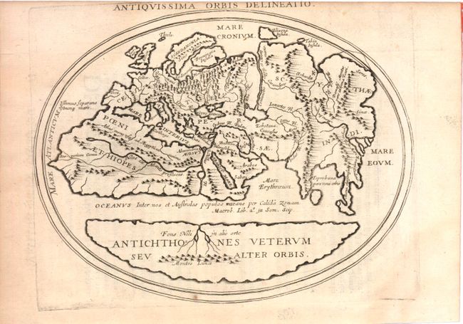
Subject: Ancient World

Period: 1649 (circa)

Publication:

Color: Black & White

Size:
8 x 6.3 inches
20.3 x 16 cm
Download High Resolution Image
(or just click on image to launch the Zoom viewer)

This interesting map shows two distinct regions of the earth in antipodean balance. The inhabited Afro-Eurasian continent was balanced by an unknown, and relatively equal, landmass (Antichthones Veterum seu Alter Orbis) on the other side of an impassable torrid zone and a great boiling sea. This notion of antipodean balance and landmass equivalence continued to attract Renaissance cartographers to this otherwise outmoded Roman geographical concept. Distinguished cartographers like Mercator and Ortelius incorporated this model into an immense southern continent (Australis Incongita) to balance the known lands of the world, and the division of the world into climactic zones is still in use today. Latin text on verso with page number 86 at upper left.

References:

Condition: B+

Light toning primarily along the sides of the sheet away from the image and a few minor spots. Upper margin trimmed with a tiny portion of the title missing.

Estimate: $200 - $300

Sold for: $150

Closed on 9/5/2012

Archived