Catalog Archive
Auction 141, Lot 411
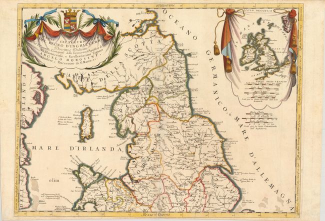
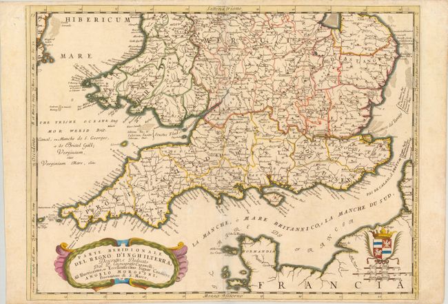
"[Lot of 2] Parte Settentrionale del Regno d'Inghilterra… [and] Parte Meridionale del Regno d'Inghilterra…", Coronelli, Vincenzo Maria
1 of 2
Subject: England & Wales
Period: 1691 (circa)
Publication: Atlante Veneto
Color: Hand Color
Size:
24 x 18 inches
61 x 45.7 cm
Download High Resolution Image
(or just click on image to launch the Zoom viewer)
(or just click on image to launch the Zoom viewer)