Catalog Archive
Auction 141, Lot 238
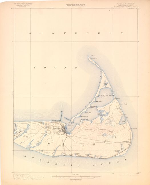
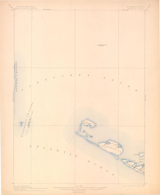
"[Lot of 2] Massachusetts (Nantucket County) Nantucket Quadrangle [and] Massachusetts Muskeget Sheet", U.S. Geological Survey (USGS)
1 of 2
Subject: Nantucket, Massachusetts
Period: 1903-05 (dated)
Publication:
Color: Printed Color
Size:
13 x 17.5 inches
33 x 44.5 cm
Download High Resolution Image
(or just click on image to launch the Zoom viewer)
(or just click on image to launch the Zoom viewer)