Catalog Archive
Auction 141, Lot 230

"Outline and Index Map of Baltimore and Environs", Hopkins, Griffith Morgan and Co.

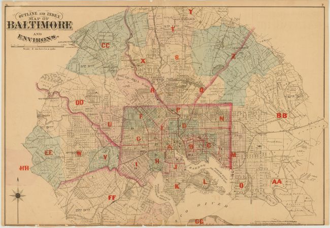
Subject: Baltimore, Maryland

Period: 1876 (dated)

Publication: City Atlas of Baltimore, Maryland

Color: Hand Color

Size:
23.8 x 16.3 inches
60.5 x 41.4 cm
Download High Resolution Image
(or just click on image to launch the Zoom viewer)

This highly detailed map shows the street-grid pattern of the city and delineates the city wards. Important buildings such as City Hall and Johns Hopkins hospital are noted, as well as the tracts of property owners along the edge of the city. Drawn at a scale of 2 inches per mile.

References:

Condition: B

There are a number of small edge tears and chips mostly closed on verso, with one tear entering 1.5" into the image at bottom. Two very small portions of the lower neatline have been replaced in facsimile. There are several extraneous creases, with a few abrasions and small spots in the image.

Estimate: $150 - $200

Sold for: $100

Closed on 9/5/2012

Archived