Catalog Archive
Auction 141, Lot 124

"[Lot of 2] A Perspective View of Quebec Drawn on the Spot [and] A Map of the Island of Orleans with the Environs of Quebec",

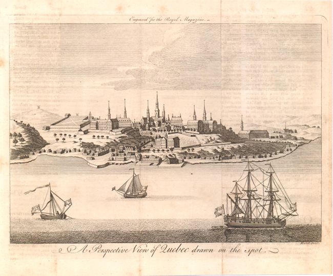
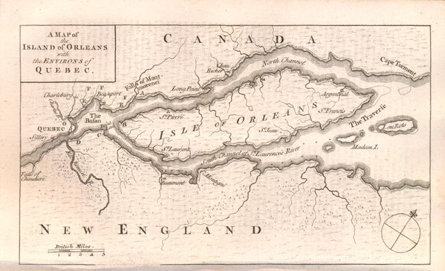
Subject: Quebec City, Canada

Period: 1759 (dated)

Publication:

Color: Black & White

Size:
See Description
Download High Resolution Image
(or just click on image to launch the Zoom viewer)

A. A Perspective View of Quebec Drawn on the Spot, by J. Hulett, from The Royal Magazine, (9 x 6.8"). This great view of Quebec was engraved for the Royal Magazine by Hulett. The December 1759 issue contains a map of the St. Laurence describing the siege of Quebec (ROYMAG-6); this view is likely from the same issue. The perspective is from the river with one large 3-masted ship and two local sailboats in the foreground with the city and its large buildings well rendered. Condition: Light offsetting from opposing text page and a few spots primarily confined to the blank margins. (B+)

B. A Map of the Island of Orleans with the Environs of Quebec, from The Gentleman's Magazine, (7.5 x 4.5"). This uncommon French and Indian War map was published in the October 1759 edition of Gentleman's Magazine. At the time Quebec was France's strongest fortress in Canada. The nearly three month long siege ended on September 18th, 1759, when the French surrendered to the British General Wolfe. This victory was the turning point of the war. Centered on the Isle of Orleans the map locates Quebec, The Bason, Cape Torment, The Traverse, Beaumont, and the falls of Chaudiere and Montmorenci. British scale of miles and simple compass rose. Still bound into the October 1759 issue. Condition: Minor offsetting from opposing text page. (A)

References: Jolly #GENT-136.

Condition:

See descriptions above.

Estimate: $300 - $400

Sold for: $150

Closed on 9/5/2012

Archived