Catalog Archive
Auction 140, Lot 710

"Tabula Geographica in Qua Regiones Cananaeae, et Locorum Situs Prout ea tempore Christi, et Apostolorum suerunt de integro describuntur, ac suis Limitibus distinguntur Auctore Petro Plancio", Plancius/Cloppenburg
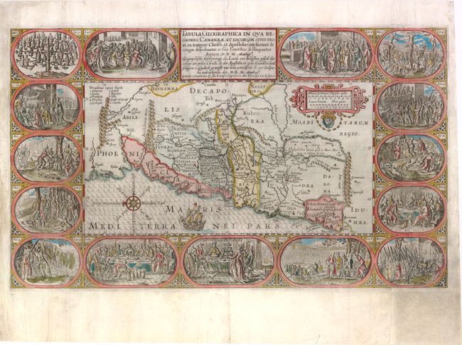
Subject: Holy Land

Period: 1643 (circa)

Publication:

Color: Hand Color

Size:
19.5 x 11.5 inches
49.5 x 29.2 cm
Download High Resolution Image
(or just click on image to launch the Zoom viewer)

A superb and graphic map from a Dutch Bible depicting the land of Canaan with political divisions during the time of Christ. Fifteen vignettes illustrating the life of Christ surround the map, beginning with the genealogy of Jesus and ending with his appearance to the disciples after the Resurrection. The map is nicely detailed and is decorated with a strapwork scale cartouche, sailing ship and a compass rose orienting north to the left. Second state with D.R.M. Mathes added to imprint. Dutch text on verso.

References: Laor #569; Poortman & Augusteijn #80.

Condition: C+

There is some minor soiling, a few printer's creases and two professionally repaired tears that extend 2" to 3" from the centerfold. There are several large chips in left blank margin that have been expertly repaired with some of border and vignettes in facsimile, along with a large chip in bottom right corner with an area 1.5" by 2.5" of bottom vignette replaced in facsimile.

Estimate: $900 - $1,100

Unsold

Closed on 5/23/2012

Archived