Catalog Archive
Auction 140, Lot 638

"[Lot of 2] The Crimea [and] Plan of The Battle of the Alma", Tallis, John

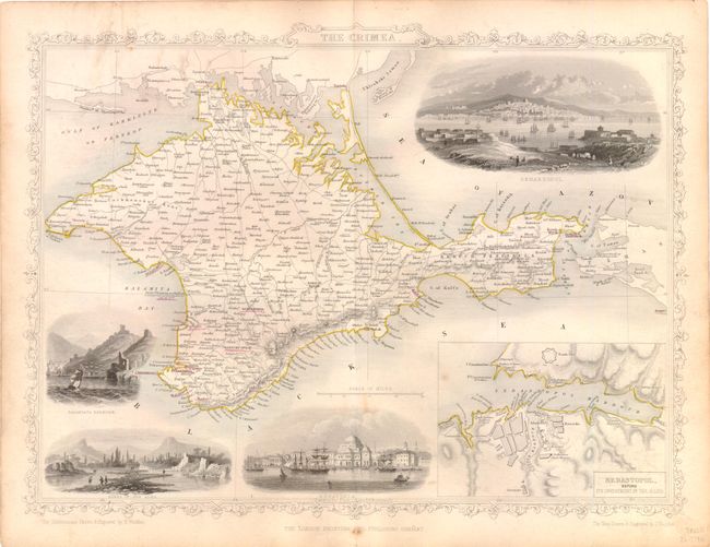
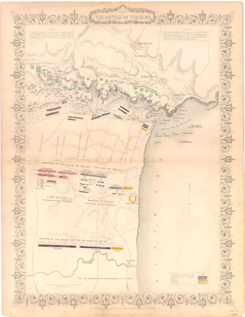
Subject: Crimea, Ukraine

Period: 1850-60 (circa)

Publication:

Color: Hand Color

Size:
13.5 x 10 inches
34.3 x 25.4 cm
Download High Resolution Image
(or just click on image to launch the Zoom viewer)

The maps from The Illustrated Atlas were first published in serial form to a target audience that led insular lives due to the expense and hardship of travel. All that changed as the progress of the nineteenth century brought swift and dramatic changes in public awareness of far away places. Tallis' maps no doubt played an important role in this dramatic awakening. These maps not only provided up-to-date geographical knowledge, but also used vignette views within the map's design to show the native people and their occupations, cities and points of interest. The maps hark back to a cartographic tradition from the Dutch mapmakers of the seventeenth century with finely engraved decorative borders. The maps were drawn and engraved by John Rapkin with views drawn and engraved by a number of prominent artists. The maps were issued as a complete volume from 1851 until about 1865. Some of the maps were also published in other history books published by Tallis including British Colonies and, without the vignettes, in geographical dictionaries and encyclopedias until about 1880.

These two steel engraved maps show great detail of the Crimean Peninsula around the time of the Crimean War (1853-1856), which was a battle between the Russian Empire and several European powers for influence over territories of the declining Ottoman Empire. The Crimea is a detailed map of the Crimean Peninsula prior to the war. The map includes a large inset of "Sebastopol before its investment by the Allies," and four vignettes: Sebastopol, Eupatoria, Banks of the Alma, and Balaklava Harbour. Plan of The Battle of the Alma is a detailed Crimean War battle plan showing the positions of all the armies and the Allied Blockade in 1854. The maps are surrounded in delicately engraved borders, and were drawn and engraved by John Rapkin, with the beautifully engraved vignettes by H. Winkles.

References:

Condition: B+

Original color with a few unobtrusive spots and light toning and soiling in blank margins.

Estimate: $200 - $240

Unsold

Closed on 5/23/2012

Archived