Catalog Archive
Auction 140, Lot 366

"A New Mapp of the Island of St. Christophers being an Actuall Survey Taken by Mr. Andrew Norwood", Mount & Page

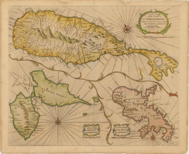
Subject: Lesser Antilles - St. Kitts, Guadeloupe, Martinique

Period: 1770 (circa)

Publication: The English Pilot

Color: Hand Color

Size:
21 x 17 inches
53.3 x 43.2 cm
Download High Resolution Image
(or just click on image to launch the Zoom viewer)

This is an excellent map of St. Christophers, now known as St. Kitts, showing the parishes, forts, settlements, and churches. The map is beautifully composed with two other maps on the same sheet. They are inset into the main map with a vine border and each has its own cartouche and compass rose; A New Mapp of the Island of Guadalupa, and A New Mapp of the Island of Martineca.

References: Shirley (BL Atlases) M.M&P-5h #15.1-3.

Condition: B+

Light toning and offsetting with some printer's ink residue. There are some small tears and chips in blank margins that have been archivally repaired, one of which just enters neatline at top.

Estimate: $500 - $600

Sold for: $275

Closed on 5/23/2012

Archived