Catalog Archive
Auction 140, Lot 334

"Mexico, California & Texas", Black, Adam & Charles

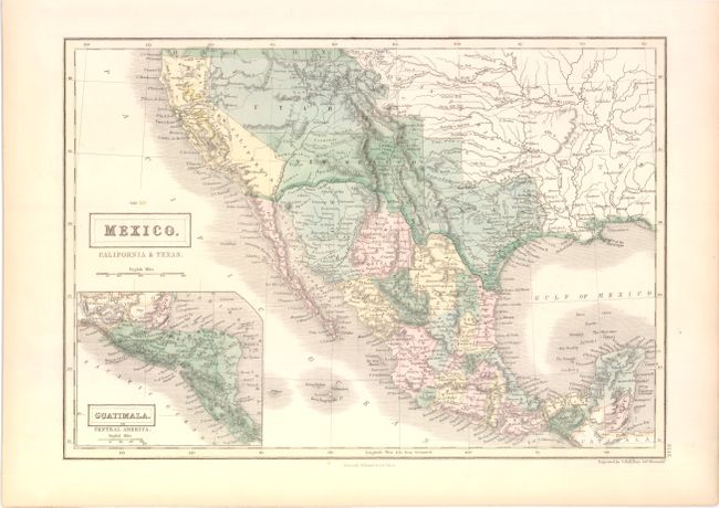
Subject: Southwestern United States & Mexico

Period: 1851 (circa)

Publication: Black's General Atlas

Color: Hand Color

Size:
14.5 x 10.3 inches
36.8 x 26.2 cm
Download High Resolution Image
(or just click on image to launch the Zoom viewer)

This delicately engraved map depicts Mexico and the region recently acquired by the United States in the Mexican/American War. The map features a pre-Gadsden Purchase border between Mexico and the United States. California is still labeled as Upper or New California, but the border clearly matches California's boundaries as we know them. This map is likely from California's military government status prior to achieving Statehood in 1850. The rivers of the Gold Region are well shown and hand colored in yellow. There is good detail of the Californian missions and early forts throughout the Southwest. The huge Utah Territory stretches between California and Indian Territory, and Texas is oversized and misshapen, but gives extensive early information. Numerous Indian Tribes are also located, including the Moquis, Apaches, Pima, Utes and more. An inset map of Central America is featured in the Pacific, titled "Guatimala or Central America." Engraved by Sidney Hall.

References:

Condition: A

Original color with a hint of toning in blank margins.

Estimate: $200 - $240

Sold for: $150

Closed on 5/23/2012

Archived