Catalog Archive
Auction 140, Lot 261

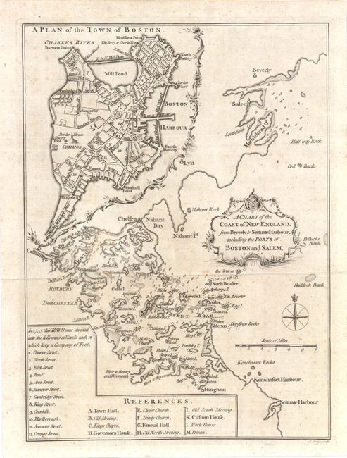
"A Chart of the Coast of New England, from Beverly to Scituate Harbour, including the Ports of Boston and Salem", Lodge, John

Subject: Boston, Massachusetts

Period: 1774 (published)

Publication: London Magazine

Color: Black & White

Size:
7 x 9.5 inches
17.8 x 24.1 cm
Download High Resolution Image
(or just click on image to launch the Zoom viewer)

This is an uncommon chart of the greater Boston Harbor area, with a detailed plan of the city of Boston in the upper left quadrant. Of particular interest is the Boston Common on which the Liberty Tree and Powder House are noted. This was the Elm tree under which early protestors gathered in the 10 years preceding the American Revolution. It was chopped down in 1775 by Loyalists, but became a symbol of the Revolution and was proudly displayed on battle flags. At bottom left is an index with the 12 original wards of Boston and a listing of 12 major public buildings.

References: Jolly LOND-304.

Condition: B+

There are a few faint spots in the image.

Estimate: $300 - $400

Sold for: $400

Closed on 5/23/2012

Archived