Catalog Archive
Auction 139, Lot 680

"Carte d'Afrique Dressee pour l'Usage du Roy…", Delisle/Covens & Mortier
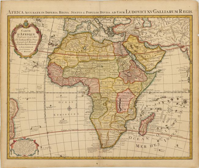
Subject: Africa

Period: 1730 (circa)

Publication: Atlas Geographique et Universel

Color: Hand Color

Size:
24.5 x 20 inches
62.2 x 50.8 cm
Download High Resolution Image
(or just click on image to launch the Zoom viewer)

This is the Covens & Mortier edition of Delisle's second map of the continent (1722). Delisle's first map of 1700 was a landmark in the mapping of the continent; the first to show the Nile's source in Lake Tana, rather than on the Ptolemaic concept, and the first to correctly show the width of the northern shape of Africa. In this updated map, Lake Maravi (Malawi) in Central Africa appears for the first time, and the Senegal and Niger Rivers are correctly separated. The major kingdoms and tribes are shown. In this edition, Hellenbok in South Africa has been corrected to Stellenbosch, and a note on the discovery of the Cape has been added off the south coast. Two decorative cartouches grace the map, and the Latin dedication title appears in the top margin, Africa Accurate in Imperia, Regna, Status & Populos Divisa ad Usum Ludovici XN Galliarum Regis. Engraved by J. Kondet.

References: Tooley (MCC-48) p.58; Norwich #78; Betz p. 498.

Condition: A

Faint toning along centerfold at bottom, and a small chip in right blank margin, far from map image.

Estimate: $500 - $700

Sold for: $350

Closed on 2/15/2012

Archived