Catalog Archive
Auction 139, Lot 553

"Carte du Detroit de Gibraltar Dressee au Depost des Cartes et Plans de la Marine pour le Service des Vaisseaux Francais…", Bellin, Jacques Nicolas
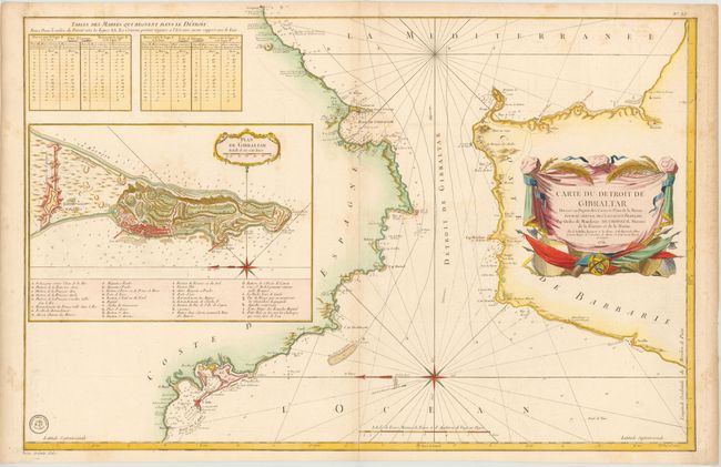
Subject: Gibraltar

Period: 1761 (dated)

Publication:

Color: Hand Color

Size:
35 x 22.3 inches
88.9 x 56.6 cm
Download High Resolution Image
(or just click on image to launch the Zoom viewer)

This is a highly detailed chart of Gibraltar and both the adjacent Spanish and African coasts. It provides an excellent view of the fortifications and coastal topography, along with soundings, navigational hazards, and safe anchorages. The chart is oriented with north to the left. A large inset, Plan de Gibraltar, shows a bird's-eye plan of the town and surrounding fortifications with a key to 34 locations. At top left are two tables outlining the tides in the straits. The seal of the Depot de la Marine is at bottom left with Prix trente Sols below the neatline.

References:

Condition: B+

Watermarked paper with light toning along centerfold and marginal soiling. There are two short tears in top blank margin that just enter map image and have been professionally repaired.

Estimate: $275 - $350

Sold for: $375

Closed on 2/15/2012

Archived