Catalog Archive
Auction 139, Lot 442

Blaeu's Beautiful Plan of Amsterdam

"Amstelodami Celeberrimi Hollandiae Emporii Delineatio Nova", Blaeu, Johannes

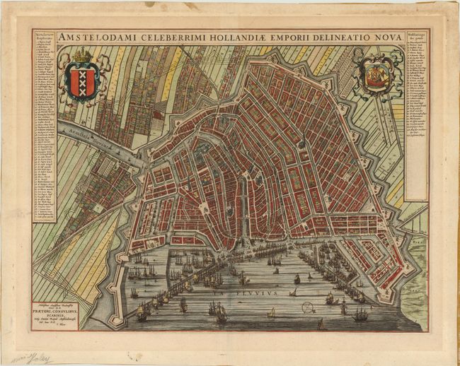
Subject: Amsterdam, Netherlands

Period: 1650 (circa)

Publication:

Color: Hand Color

Size:
21.3 x 16.3 inches
54.1 x 41.4 cm
Download High Resolution Image
(or just click on image to launch the Zoom viewer)

This attractive bird's-eye plan of Amsterdam shows the city during it's Golden Age as one of the leading trading empires of Europe. The plan shows the city center enclosed within the medieval town walls. The new expanded city limits and canal systems are depicted with fortifications built-out on the right and drawn in dotted lines to show the area to be enclosed on completion of the construction. Thousands of tiny buildings are shown divided by the Amstel river, with the stock exchange and fish market at center, and many windmills dotting the outer city wall. At left and right there is an impressive key with 107 numbered locations. In the foreground are numerous sailing ships and docks fill the busy port. The city's coat of arms is at left and arms of the VOC is on right. Johannes Blaeu produced this map for the Groot Toonneel der Steden or Town Atlas of the Low Countries in 1649 to commemorate Dutch independence from Spain at the conclusion of the Eighty Years' War. Latin text on verso.

References:

Condition: B+

Fine old color with a few small spots primarily in the blank margin with remnants of paper tape on verso along the edges of the sheet and centerfold.

Estimate: $3,000 - $4,000

Sold for: $2,750

Closed on 2/15/2012

Archived