Catalog Archive
Auction 139, Lot 168

Very early map of the Pennsylvania Railroad

"Map of the Pennsylvania Railroad with its Connections, Showing the Different Routes, Projected or Constructed between the Seaboard & the Western States", Railroad Companies, (Various)

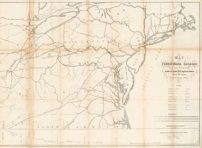
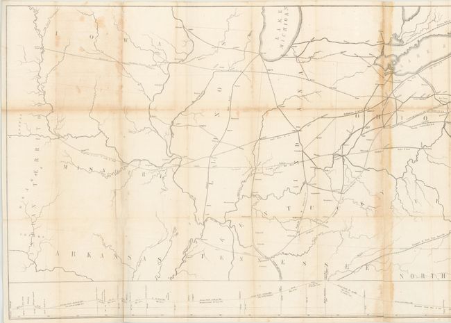
Subject: Mid-Atlantic United States

Period: 1850 (published)

Publication:

Color: Black & White

Size:
55 x 23.3 inches
139.7 x 59.2 cm
Download High Resolution Image
(or just click on image to launch the Zoom viewer)

This rare, large format map provides an early view of the Pennsylvania Railroad, which was founded in 1846. It shows existing and proposed railroads from the Eastern Seaboard west to Missouri and Indian Territory and outlines the ambitious plans of the nascent railroad company. At bottom is a profile view of the Pennsylvania Railroad that runs from Philadelphia to Pittsburgh. Below the title cartouche are distances for routes between major cities. The map folds into the "Report of the President and Managers of the Philadelphia, Germantown and Norristown Rail Road Company, to the Stock and Loan Holders" which outlines the financial performance of the company and is accompanied by a manuscript page showing projected revenue and expenses for 1851. The Pennsylvania Railroad completed the initial line from Harrisburg to Pittsburgh in 1854 and soon grew to be the largest railroad in the United States. Lithographed by Friend & Aub and printed on two joined sheets.

References: Modelski #516.

Condition: B

There is some light toning along folds and a few short splits at fold intersections.

Estimate: $500 - $600

Sold for: $300

Closed on 2/15/2012

Archived