Catalog Archive
Auction 139, Lot 164

"Nova Virginiae Tabula", Hondius/Blaeu

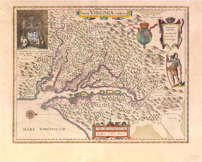
Subject: Colonial Mid-Atlantic

Period: 1640 (circa)

Publication: Theatrum Orbis Terrarum

Color: Hand Color

Size:
19 x 14.8 inches
48.3 x 37.6 cm
Download High Resolution Image
(or just click on image to launch the Zoom viewer)

The early settlement of Jamestown is noted as Iamestowne, and there are a number of other place names, both English and Native American. The map was derived from Capt. John Smith's map of 1612, which was the first to depict the bay and its tributaries with any accuracy. In the upper left corner is an engraving of the great Indian chief, Powhatan, seated on his throne and surrounded by his subjects. A Susquehanna chief is depicted on the right under the British coat-of-arms and a key cartouche. The plate was engraved by Dirck Grijp and was originally published by Jodocus Hondius Jr. in 1618. It was purchased by Willem Blaeu shortly after Hondius' death (1629) and Blaeu's imprint replaced that of Hondius. Latin text on verso.

References: Burden #193; Tooley (Amer) pp. 165-66.

Condition: B+

There is some scattered light foxing primarily confined to the blank margins and a short printer's crease just above the compass rose.

Estimate: $3,000 - $4,000

Sold for: $1,900

Closed on 2/15/2012

Archived