Catalog Archive
Auction 139, Lot 135

Rare, Early Edition Mitchell Wall Map

"Map of the United States by J.H. Young", Mitchell, Samuel Augustus

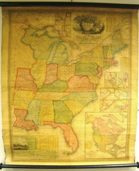
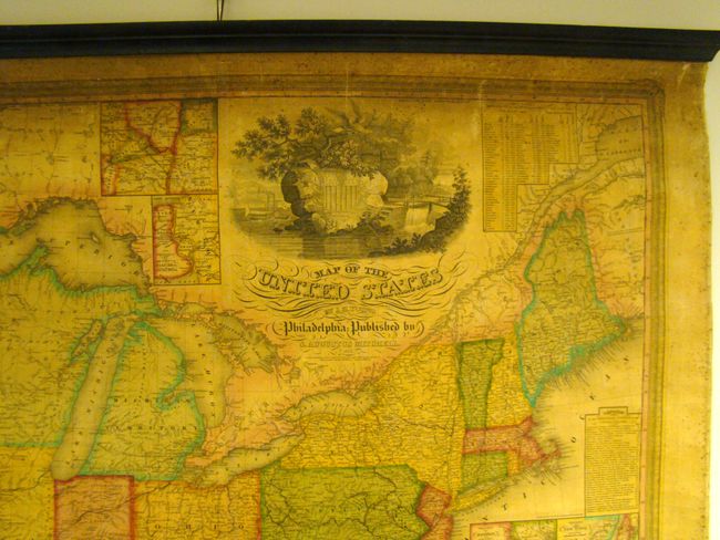
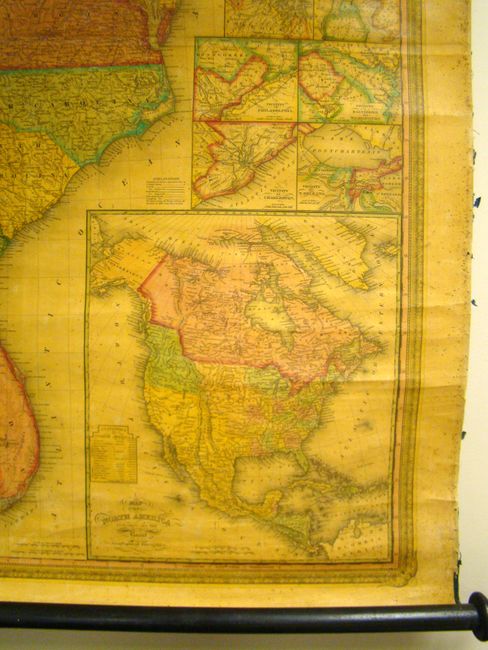
Subject: United States

Period: 1833 (dated)

Publication:

Color: Hand Color

Size:
35 x 44 inches
88.9 x 111.8 cm
Download High Resolution Image
(or just click on image to launch the Zoom viewer)

This is one of the earliest steel-engraved maps created in the United States, a process favored by James H. Young. The commercial success of this map propelled his business to a position of dominance in American map making. It also signaled the beginning of the long alliance between Mitchell and the brilliant engraver Young, whose aesthetic sense and precision are beautifully showcased here. Mitchell and Young began making maps at the start of grand national expansion, following the expeditions of Lewis and Clark, Pike, and others; their path finding stimulated an interest in the West and thus created a strong market for maps and guidebooks.

This is a rare, early edition of the Young/Mitchell wall map, which was first issued in 1831. The map extends west to Missouri and Arkansas Territory, or to about today’s 95th meridian, but the map uses only "Longitude West from Washington." Michigan is a territory and the huge area west of Lake Michigan later known as Western Territory is here simply labeled "Attached to Michigan." There is remarkable detail throughout with a large number of early towns, villages and wagon roads noted. Of special interest are the individual mileages given on every road between every junction, an astounding accomplishment.

With three tables: "Statistics of the United States" shows population to 1830 including whites, free blacks, and slaves; "Distances on the Erie and Champlain Canals"; and "Lengths of the Principle Canals in the United States." The two thematic charts are "Comparative Lengths of the Principle Rivers of the United States" and "Comparative Heights of the Principle Mountains and Hills in the United States." Plus six city plans: Boston; New York, Philadelphia; Baltimore & Washington; Vicinity of Charleston; and Vicinity of N. Orleans.

The large inset map of North America includes "all the Recent Geographical Discoveries." This map shows a huge Missouri Territory, and the border in the northwest extends well into today’s British Columbia reflecting the U.S. position in the Oregon boundary dispute between the United States and Great Britain. A large Great Desert encompasses much of the American West.

The cartouche is a tour-de-force in design for which Ristow devotes a paragraph describing the United States shield on a rock from which grows a tree with a large eagle. Around the tree is a harbor scene with steam and sailing ships and an early rendering of a steam locomotive: all modes of transportation that made western expansion possible. Fancy lettering and flourishes complete the cartouche and the map is surrounded by a decorative border.

References: Ristow p. 309; Rumsey #2723.

Condition: B+

Nice bright copy with some minor foxing primarily in the blank margins. There is some toning in the upper portion of the image with two tiny tears in the upper blank margin, one just extending past the neat line. Both rollers are present and attached, with the top roller supported by tacks. The ribbon edge is deteriorated. Overall very good, original condition for this type of map.

Estimate: $1,000 - $1,500

Sold for: $1,200

Closed on 2/15/2012

Archived