Catalog Archive
Auction 136, Lot 86

A great map for the Northwest Passage collector

"Carte de l'Amerique Septentrionale & Meridionale…", Herisson, Eustache

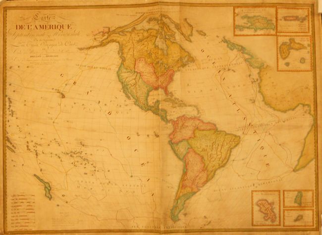
Subject: Western Hemisphere - America

Period: 1829 (dated)

Publication:

Color: Hand Color

Size:
47 x 34 inches
119.4 x 86.4 cm
Download High Resolution Image
(or just click on image to launch the Zoom viewer)

This uncommon French wall map of the Americas shows the three voyages of Captain Cook, along with the tracks of Vancouver, Mackenzie, and La Perouse. This edition also includes the discoveries of Parry and Franklin in the Canadian arctic. Its most distinguishing feature is a depiction of the long-sought after Northwest Passage, which had been a major goal of all these important expeditions. The map extends beyond the Americas to include nearly all the South Pacific with both islands of New Zealand shown. It also extends to show western Europe and Africa. The map presents a strangely shaped United States and British claims well south of the Columbia River in the Pacific Northwest. Six insets feature islands in the West Indies.

References:

Condition: B

Professionally backed with paper. There is evidence in the top and bottom margins that the map was once attached to rollers, now lacking. There is some surface soil and creases, but overall good for a map of this size.

Estimate: $550 - $750

Sold for: $400

Closed on 6/1/2011

Archived