Catalog Archive
Auction 136, Lot 757

"A Map of the Discoveries made by the Russians on the North West Coast of America. Published by the Royal Academy of Sciences at Petersburg", Jefferys, Thomas

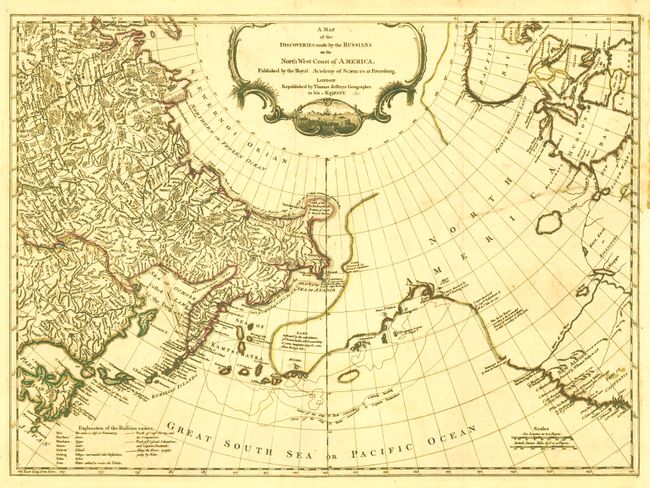
Subject: North Pacific Ocean

Period: 1761 (circa)

Publication:

Color: Hand Color

Size:
24.5 x 17.8 inches
62.2 x 45.2 cm
Download High Resolution Image
(or just click on image to launch the Zoom viewer)

This map, by Thomas Jefferys, is based on Gerhard Mueller's map of 1758, which was one of the first to correctly depict the Kurile Islands and also suggest the outline of Alaska and the Aleutian chain. It shows great detail of the Arctic coast of Siberia based on Vitus Bering's Second Kamchatka expedition from 1733-43, and illustrates the sea routes made by Captains Bering and Chirikof. In the largely unexplored North America, the River of the West is boldly shown extending to Lake Winipigon. The discoveries of several different explorers are shown along the coast, including those of Bering, Tschirikow, and Sir Francis Drake. The map includes a decorative title cartouche with an inset illustration of a ship, several small vessels and a whale.

References: Wagner (NW) #597; Falk #1761-3.

Condition: B

Issued folding with original outline color. A 7" tear from right-hand side has been professionally repaired and does not distract. The binding trim has been replaced at right. Backed with Japanese tissue.

Estimate: $600 - $800

Sold for: $550

Closed on 6/1/2011

Archived