Catalog Archive
Auction 136, Lot 533

"Lutece ou Premier Plan de la Ville de Paris…", Danet, Guillaume

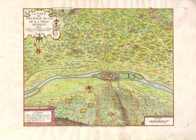
Subject: Paris, France

Period: 1724 (circa)

Publication:

Color: Hand Color

Size:
10.8 x 8.5 inches
27.4 x 21.6 cm
Download High Resolution Image
(or just click on image to launch the Zoom viewer)

This rare and detailed map of Paris during Roman times depicts the topography around Paris and prominently features the Seine River. Three temples are identified: Temple de Mars ou Teutates, Temple d'Isis ou de Ceres, and Temple de Mercure ou de Hesus. In addition, the homes and properties of the Gaulois in the countryside are depicted. The map includes two decorative cartouches and a distance scale. The map was based on de Fer's work, and was published by Guillaume Danet, the son-in-law and part successor of De Fer.

References: Tooley, p. 146

Condition: A

Strong impression, with small stain just outside of upper neat line.

Estimate: $240 - $300

Sold for: $180

Closed on 6/1/2011

Archived