Catalog Archive
Auction 136, Lot 189

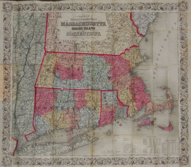
"Railroad & township map of Massachusetts, Rhode Island and Connecticut", Colton, Joseph Hutchins

Subject: United States - New England

Period: 1853 (dated)

Publication:

Color: Hand Color

Size:
28 x 25 inches
71.1 x 63.5 cm
Download High Resolution Image
(or just click on image to launch the Zoom viewer)

This large and beautifully colored pocket map is printed on fine, banknote-quality paper. Colored by county, it shows the states in splendid detail, with numerous place names, rivers, forts and existing and Common roads. The emerging railroad system is well shown. Also includes a legend, distance scale and a table showing population by county. The map is surrounded by a wide, decorative leaf and vine border. Folds into original red cloth boards with extensive decorative embossing on front and back, and gilt title on front. Paper label on inside front cover lists numerous maps available in both "mounted and pocket form" from the publisher.

References:

Condition: A

Very early, strong impression and bright original coloring. On thin banknote quality paper that is supple with no apparent flaws save for two small areas of foxing. Covers are exceptional with virtually no wear and just a small stain at upper edge of front cover.

Estimate: $350 - $450

Sold for: $275

Closed on 6/1/2011

Archived