Catalog Archive
Auction 135, Lot 92

"L'Amerique Septentrionale Dressee sur les Observations de Mrs. de l'Academie Royale des Sciences…", Delisle/Covens & Mortier

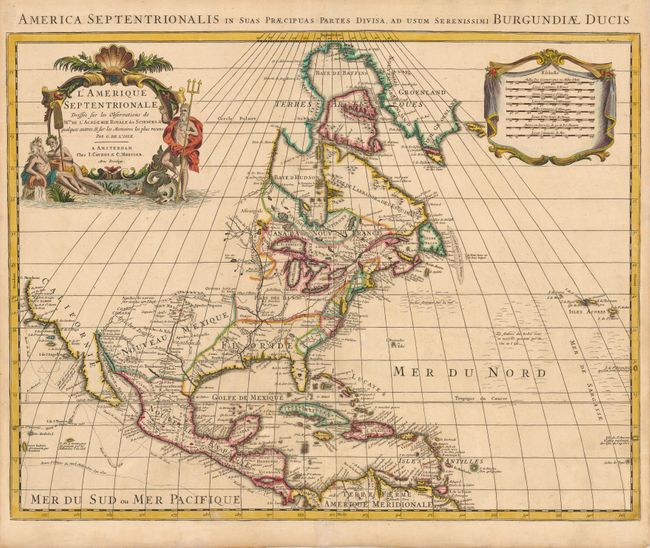
Subject: North America

Period: 1730 (circa)

Publication: Atlas Nouveau de diverses cartes…

Color: Hand Color

Size:
23 x 17.6 inches
58.4 x 44.7 cm
Download High Resolution Image
(or just click on image to launch the Zoom viewer)

This is Pierre Mortier's re-engraved version of Delisle's foundation map of North America. It is nearly identical to the Delisle map, with California returned to its peninsular position rather than as an island. Cape Mendocino is the farthest northern point in California, and the north portion of the continent is left blank. The Great Lakes are well-defined, based on Coronelli, with French forts noted. The English settlements are confined east of the Allegheny Mountains, and Spanish forts are clustered around Santa Fe. The Mississippi River valley is well developed with recent French settlements. The first mention of what would be called the Sargasso Sea is noted in the North Atlantic. The map is decorated with an aquatic-themed figural cartouche and a draped scale of miles. Latin title above the neatline, "America Septentrionalis in suas Praecipuas Partes Divisa, ad Usum Serenissimi Burgundiae Ducis."

References: Tooley (Amer) p.19, #33; Philips #580-56; cf Wheat [TMW] #79.

Condition: A

There is a minor tear and fold separation in the blank margins, not affecting the map.

Estimate: $1,000 - $1,300

Sold for: $750

Closed on 2/16/2011

Archived