Catalog Archive
Auction 135, Lot 64
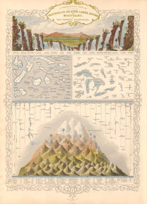
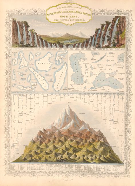
"[Lot of 2] A Comparative View of the Principal Waterfalls, Islands, Lakes, Rivers and Mountains, in the Western Hemisphere [together with] A Comparative View of the Principal Waterfalls, Islands, Lakes, Rivers and Mountains, in the Eastern Hemisphere", Tallis, John
Subject: Cartographic Miscellany
Period: 1850 (circa)
Publication: Illustrated Atlas and Modern History of the World
Color: Hand Color
Size:
10 x 14 inches
25.4 x 35.6 cm
Download High Resolution Image
(or just click on image to launch the Zoom viewer)
(or just click on image to launch the Zoom viewer)