Catalog Archive
Auction 135, Lot 571

"[Lot of 2] Plan des Ville, Chateau, Mole et Baye de Gibraltar… [and] Plan Geometral de la Montagne et de Ville de Gibraltar…", Longchamps/Bonne
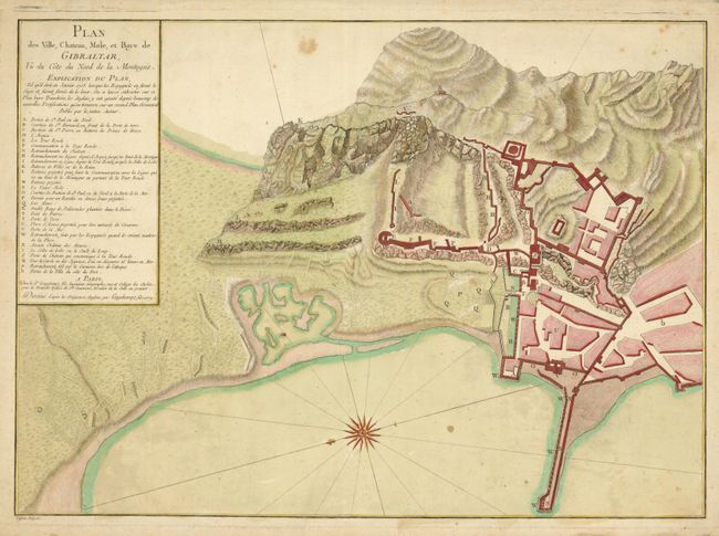
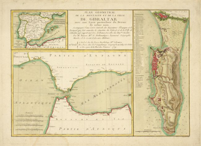
Subject: Gibraltar

Period: 1779 (dated)

Publication:

Color: Hand Color

Size:
See Description
Download High Resolution Image
(or just click on image to launch the Zoom viewer)

The European wars of the eighteenth century brought heightened interest in detailed mapping of the strategic harbors and fortifications in the Mediterranean. These maps were published at the beginning of the last great (and ultimately unsuccessful) siege of the Rock undertaken by the French and Spanish 1779-83, when the American Revolutionary War had diverted British resources elsewhere.

Plan des Ville, Chateau, Mole et Baye de Gibraltar… , (21.5 x 15.5")
Plan Geometral de la Montagne et de Ville de Gibraltar…, (18.4 x 13.2")

References:

Condition: B+

Original color with some minor foxing in the maps and light damp stains and tears in the blank margins.

Estimate: $500 - $600

Sold for: $500

Closed on 2/16/2011

Archived