Catalog Archive
Auction 135, Lot 456

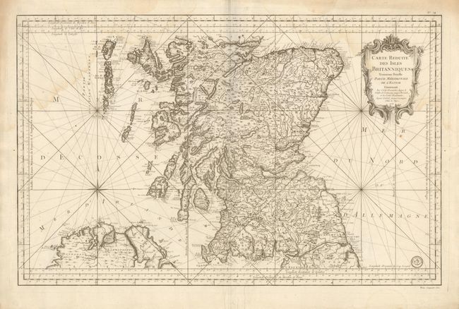
"Carte Reduite des Isles Britanniques Troisieme Feuille Partie Meridionale de l'Ecosse", Bellin, Jacques Nicolas
Subject: Scotland

Period: 1757 (dated)

Publication: Hydrographie Francoise

Color: Black & White

Size:
34 x 21.8 inches
86.4 x 55.4 cm
Download High Resolution Image
(or just click on image to launch the Zoom viewer)

This superb, large-scale chart details southern Scotland plus the northern tip of Ireland. Also shows a small portion of Durham and Cumberland. Adrian's Wall is noted as the Roman wall and is well shown stretching from Newcastle to Solway Firth. Extends through Scotland north into the North West Highlands and to Murray Firth. Along the west coast the islands are shown in great detail. Locates the cities of Edinburgh, Dundee, Aberdeen, Glascow and Iverness plus scores of towns and villages, and delineates wagon roads and trails, rivers and mountains. This map is distilled from Bellin's larger, separately issued maps of the British Isles. The chart is embellished by a large title cartouche, compass rose and numerous rhumb lines. The map carries Depot de la Marine stamp. The cost Prix, cinquante sols is given at lower right beneath the border.

References:

Condition: B+

Beautiful, dark impression on thick paper with full margins. Light water stain along upper border and entering upper corners of map.

Estimate: $300 - $400

Sold for: $130

Closed on 2/16/2011

Archived