Catalog Archive
Auction 135, Lot 310

"Topographical Map of the Country between the Mohawk River and Wood Creek", Pease Lithography
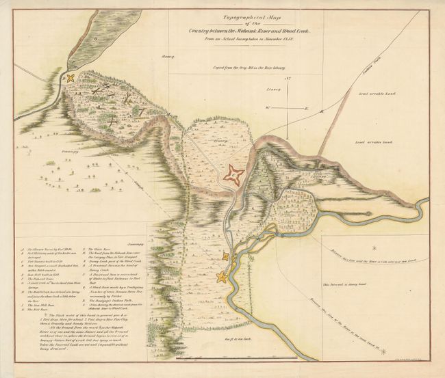
Subject: New York

Period: 1850 (published)

Publication: The Documentary History of the State of New York

Color: Hand Color

Size:
20 x 16.8 inches
50.8 x 42.7 cm
Download High Resolution Image
(or just click on image to launch the Zoom viewer)

The is a very detailed, lithographed map of the countryside surrounding forts Newport, Craven, Williams and Stanwix in the vicinity of the present-day site of Rome, New York. These forts guarded an important portage between the Mohawk River and Wood Creek, known as the Oneida Carry, along the important trade route between Albany and Lake Ontario. The region was the site of several important battles during the French and Indian War. Fort Stanwix, built by the British in 1758, was later occupied by the Continental Army during the American Revolutionary War.

References:

Condition: B+

Issued folded, now flattened and backed with archival tissue. Trimmed to neatline at left with paper added to margin.

Estimate: $130 - $180

Sold for: $110

Closed on 2/16/2011

Archived