Catalog Archive
Auction 135, Lot 276

"[Lot of 4 - Hawaii]", U.S. State Surveys
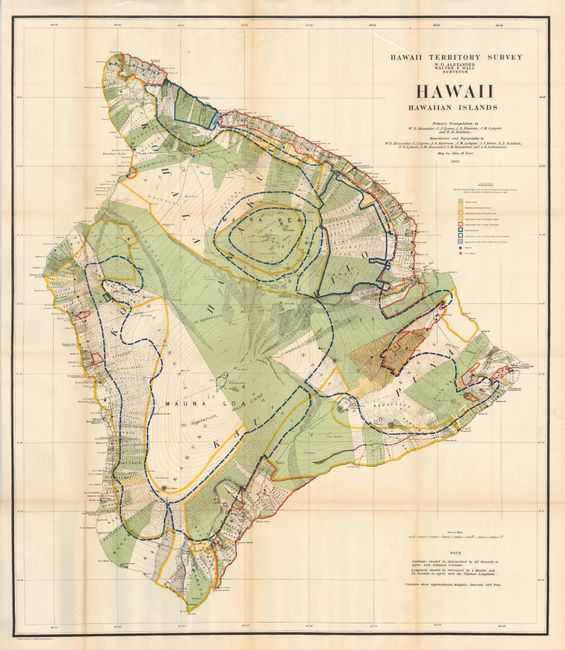
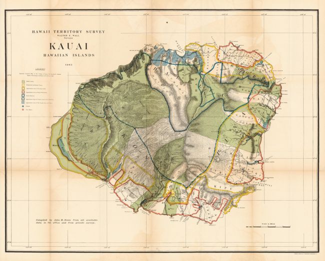
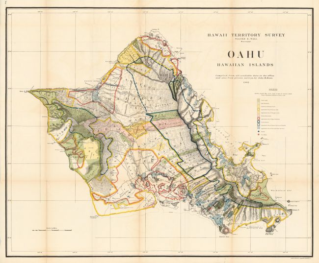
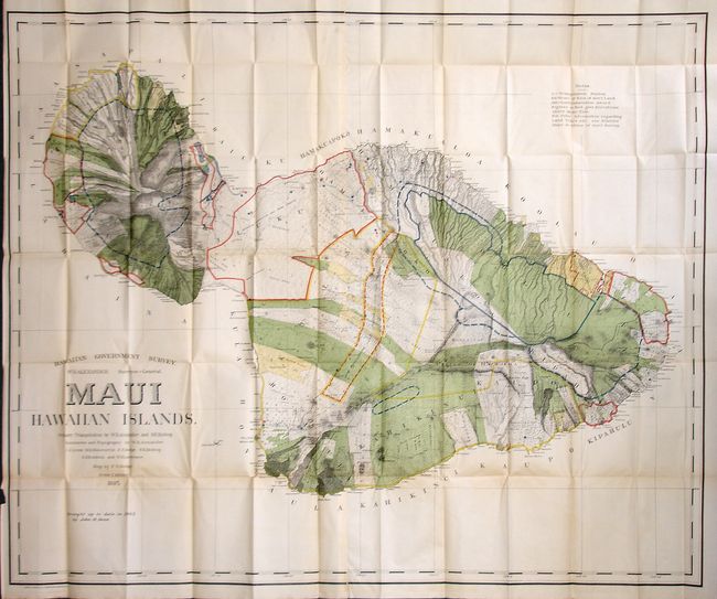
Subject: Hawaii

Period: 1901-1903 (dated)

Publication:

Color: Printed Color

Size:
See Description
Download High Resolution Image
(or just click on image to launch the Zoom viewer)

1.Hawaii Territory Survey - Hawaii Hawaiian Islands, 1901, 31" x 36". This large and beautifully lithographed map was surveyed by W.D. Alexander and Walter E. Wall. It provides terrific detail at a scale of about 3 miles per inch. Virtually the entire island is ringed with roughly 400 strips of land with the owner's name recorded. These lots are locally called ahupua'a and are the basic land division in Hawaii. They usually run from the ocean to the mountains, as can be seen here. Contour lines are drawn in red at 300 ft. intervals . Extensive legend uses color and line to delineate the approximate area of Public Lands, Homestead Settlements Tracts, Grazing Lands, Pineapple Lands, Sugar Plantations, Forest Reserves, and wet lands consisting of rice and taro. Schools and post offices are shown by colored circles. The primary triangulation was accomplished by Alexander, C.J. Lyons, J.S. Emerson, J.M Lydgate and E.D. Baldwin. A very handsome and uncommon chart of the island.

2. Hawaii Territory Survey - Kauai Hawaiian Islands, 1903, 34" x 24". Brilliantly colored and detailed map of Kauai with much information on pineapple and sugar plantations, homesteads, public lands, swampland and unsurveyed areas. This very attractive example delineates public and private family holdings as well as rice fields, sugar plantations, roads, schools, forts and the location of a wireless telegraph pole. Hawaii's monarchy was overthrown in 1893, and this map was prepared for the Governor's Annual Report of 1906. The governor at this time was George R. Carter.

3.Hawaiian Government Survey - Maui Hawaiian Islands, 1903, 52.3" x 43.3". This is a large and handsome map that depicts Maui in great detail shortly after its annexation by the United States. Maui was the main island of the "county group" with a population approaching 40,000. Survey work during the previous decade had resulted in preparation of good maps, but there remained the problem of laying out the lands for settlement under existing land laws. This map delineates those lands for sale, awarded lands, and much more. The map was made under the direction of W.D. Alexander, Surveyor General. It was drawn by F.S. Dodge in 1885, with topography by Alexander, Dodge, C.J. Lyons, M.D. Monsarrat, S.E. Bishop, E.D. Baldwin, and W.R. Lawrence. This edition has been updated to 1903 by John M. Donn. A lovely example with strong coloring and fine line.

4.Hawaii Territory Survey - Oahu Hawaiian Islands, 1902, 33" x 27". A brilliantly colored and detailed map of Oahu with much information on pineapple and sugar plantations, homesteads, public lands, Crown lands and public buildings. The areas of Diamond Head, Koko Head and Kailua Bay are described, as well as the charmingly-named Cocoa-Nut Grove on Maunaloa Bay, complete with tiny coconut trees. Hawaii's monarchy was overthrown in 1893, and this map was prepared for the Governor's Annual Report of 1906. The governor at this time was George R. Carter.

References:

Condition: A+

An exceptional set of these large, brightly colored maps. Occasional light color offsetting as always seen on these maps.

Estimate: $275 - $375

Sold for: $800

Closed on 2/16/2011

Archived