Catalog Archive
Auction 135, Lot 231

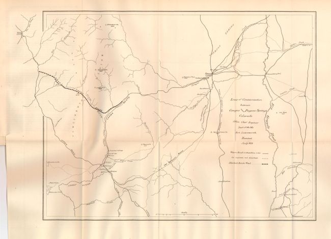
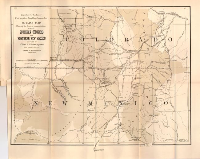
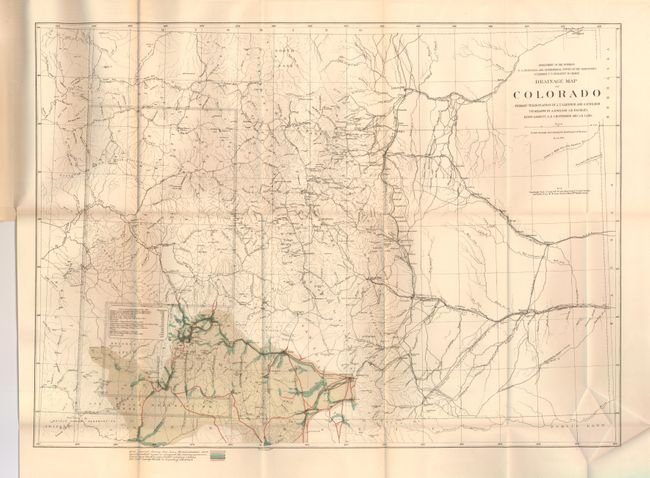
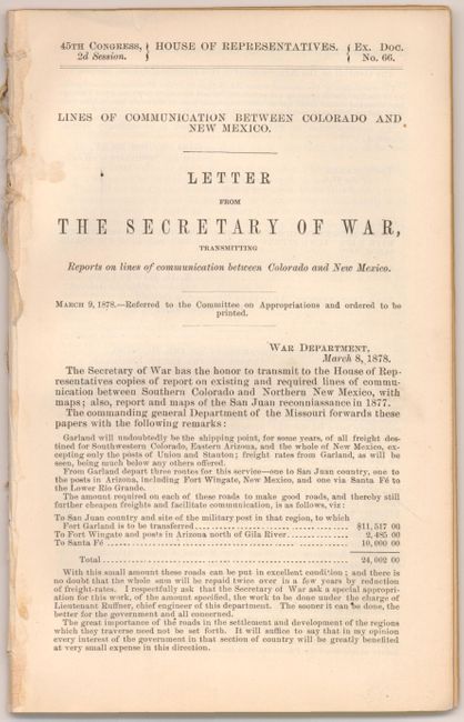
"Lines of Communication between Colorado and New Mexico", Ruffner, Lt. E.H.

Subject: Southwestern United States

Period: 1878 (published)

Publication: HR Ex. Doc. No. 66, 45th Cong. 2d Sess.

Color: Black & White

Size:
See Description
Download High Resolution Image
(or just click on image to launch the Zoom viewer)

This 38pp report by E.H. Ruffner, First Lieutenant Engineers was written from Fort Leavenworth on January 11, 1878. The disbound report is complete with the three folding maps, bound in as issued.

1) Lines of Communication between Conejos and Pagosa Springs Colorado (16.5 x 12.8") which shows wagon roads in "travelling order", those projected but not finished, and a bold line suggests the "Shortest Route West". Locates the San Antonio Route, Chama Route, the Upper Road and the route to "Tierra Amarilla via Ojo Caliente or Cuena."

2) Outline Map Showing the lines of communication between Southern Colorado and Northern New Mexico (18 x 14"). Depicts the region from Pueblo to Albuquerque and Fort Defiance to just east of Trinidad. Great topographical details as well as roads, towns, watering holes, pueblos and much more. The map was originally issued at the conclusion of Ruffner's 1873 expedition into Ute Country, to quell the unrest between the Ute Indians and the prospectors in the newly discovered San Juan Mining Region. This is the updated 1878 version, that when compared to the first issue in 1876 carries corrections including a block of territory south of Animas and west of Pagosa and was completely re-engraved without the hachure lines.

3) Drainage Map of Colorado (21 x 15.3"), printed color. This map presents a fine examination of the state showing abundant detail of towns, villages, mountain peaks, Indian Reservations, roads, railroad routes, forts, and other early detail. Hydrology is nicely developed with rivers and creeks shown in blue over-printing; no topographical information is given. The map details a large number of wagon roads, many named, and the route of the Atchison Topeka and Santa Fe, the Colorado Central, the Boulder Valley, and the Durango & Rio Grande (D. & R.G.) railroads, plus several unnamed tracks. The railroad is laid to the town of La Vita but has not yet reached the pass. A terrific map filled with information. Dated March, 1877.

References:

Condition: A

The maps are all very good (A) or fine (A+). The disbound report is equally fine.

Estimate: $300 - $400

Sold for: $230

Closed on 2/16/2011

Archived