Catalog Archive
Auction 135, Lot 177

"A Map of Maryland with the Delaware Counties and the Southern Part of New Jersey &c.", Kitchin, Thomas

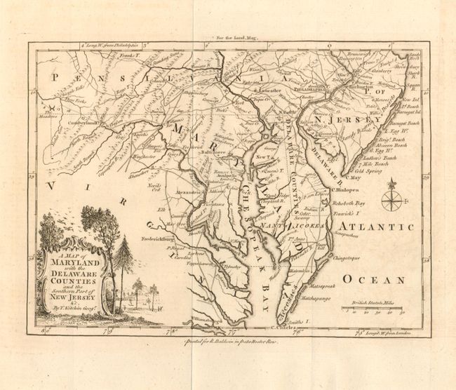
Subject: Colonial Mid-Atlantic

Period: 1757 (published)

Publication: London Magazine

Color: Black & White

Size:
8.8 x 6.5 inches
22.4 x 16.5 cm
Download High Resolution Image
(or just click on image to launch the Zoom viewer)

A fine example of this map which describes the Mid-Atlantic region during the French and Indian Wars. Centered on Annapolis the map includes all of Delaware, Maryland and the Chesapeake (here Chesopeak) Bay, with parts of New Jersey, Pennsylvania and Virginia. The map is very crisply detailed with roads, portages, forts, towns and villages, watershed and mountains. A surprising number of wagon roads fill the map, extending as far west as Cumberland Fort. Locates Harper's Ferry, Standing Stone, The Meadows, a town simply called "Dick's", Port Tabacco, several forts and more. In the western frontier there are several settlements including Crasson, Rays T., Enoch's, Nevil's Orchard, etc. The map was printed for R. Baldwin in Pater Noster Row, and appeared in the August 1757 issue of the London Magazine. As was the practice of the day, longitude from Philadelphia is noted at top, and from London along the bottom. The rococo-style title cartouche includes a scene with birds, forest and hunters.

References: Jolly LOND-122.

Condition: A

A near fine example on thick hand laid paper with a crisp impression and full margins, folding as issued. A faint suggestion of toning at lower right corner in the Atlantic.

Estimate: $250 - $350

Sold for: $300

Closed on 2/16/2011

Archived