Catalog Archive
Auction 135, Lot 156

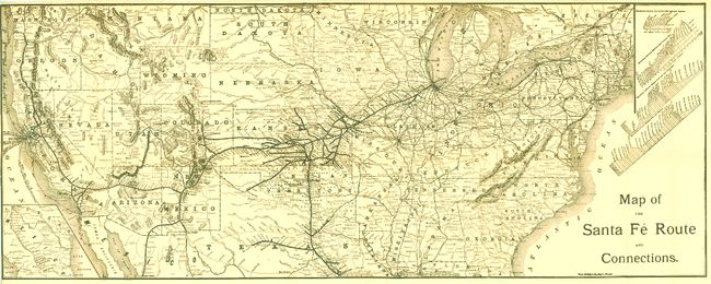
"Map of the Santa Fe and Connections", Rand McNally & Co.

Subject: United States

Period: 1890 (circa)

Publication:

Color: Black & White

Size:
38.5 x 15.3 inches
97.8 x 38.9 cm
Download High Resolution Image
(or just click on image to launch the Zoom viewer)

This issue covers the Untied States from coast to coast, north just to Seattle and Montreal, south to Galveston, and into Mexico to locate Guaymas and Chihuahua. Along the right edge in the blank Atlantic are four elevation plans showing various sections of the map. An inset map continues the rail lines from El Paso to Mexico City. Printed by Rand, McNally & Co., Engr's Chicago. There are several Santa Fe RR maps but all we know of are limited to the Southwest, making this a scarce item for which we find no other records and OCLC shows no examples. Blank verso. Source is unknown.

References:

Condition: A

Very nice condition for a large folding map from this period. Only flaw is a short virtually invisible tear with tape repair on verso. Folding as issued.

Estimate: $120 - $160

Sold for: $80

Closed on 2/16/2011

Archived