Catalog Archive
Auction 134, Lot 671

"Orientaliora Indiarum Orientalium cum Insulis Adjacentibus a Promontorio C. Comorin ad Iapan", Wit, Frederick de

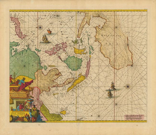
Subject: South East Asia

Period: 1675 (circa)

Publication: Atlas de la Navigation

Color: Hand Color

Size:
21.4 x 17.4 inches
54.4 x 44.2 cm
Download High Resolution Image
(or just click on image to launch the Zoom viewer)

A splendid sea chart of Southeast Asia illustrating the Dutch sphere of influence in the region. Oriented with east at top, the map is based on Pieter Goos's chart of 1666. It covers the Asian continent from India to Korea and Japan, which is presented on the Blaeu-Martini model. The chart extends through the Spice Islands to include the northern and western coastlines of Australia based on early Dutch discoveries. The map is beautifully composed with rhumb lines, compass roses, sailing ships and a superb title cartouche incorporating a compendium of symbols for the exotic east.

References: Clancy #6.13; Tooley (MCC-23) #40; Walter plt. 40.

Condition: B+

Fine impression and lovely old color with a short fold separation at bottom, just entering the border.

Estimate: $3,500 - $4,500

Sold for: $3,750

Closed on 12/1/2010

Archived