Catalog Archive
Auction 134, Lot 386

"Septentrionalium Partium Nova Tabula", Ruscelli, Girolamo

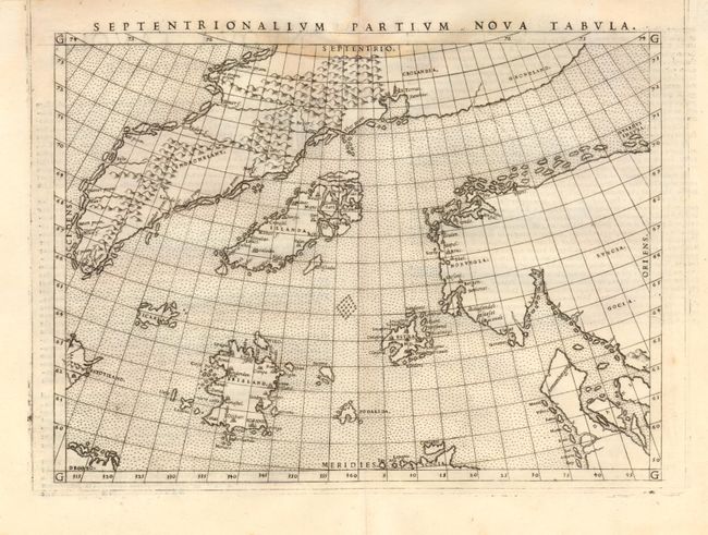
Subject: Arctic and Scandinavia

Period: 1561 (published)

Publication: La Geografia de Claudio Tolomeo Allessadrino…

Color: Black & White

Size:
9.5 x 7 inches
24.1 x 17.8 cm
Download High Resolution Image
(or just click on image to launch the Zoom viewer)

This is a reduced version of the landmark Zeno map showing the mythical islands in the North Atlantic and small coastlines of Labrador (Estotiland) and possibly Newfoundland (Drogeo). Frisland is depicted in considerable detail, with many place names indicated. The only cartographic difference between this and the woodcut map published by Zeno is that there is no land bridge between Greenland and Scandinavia on this edition. The plate mark runs off the sheet at top indicating that two maps were printed together, then separated for inclusion in the atlas. There is one surviving full, uncut sheet which reveals the sister map was the Ptolemy world. First state with Italian text on verso.

In 1558, Nicolo (the Younger) Zeno claimed to have discovered a 14th century manuscript recording a voyage made by his ancestors Nicolo and Antonio. According to the text, in the year 1380 a storm swept the Zenos into the North Atlantic where they found a group of unknown lands named Frisland, Estotiland, Estland, Icaria, and Drogeo. As a result, maps throughout the 16th century continued to show these fictional islands, especially Frisland.

References: Burden #29; Ginsberg #19; Manasek #19.

Condition: B+

Light damp stain intruding into the map at upper border.

Estimate: $550 - $700

Sold for: $325

Closed on 12/1/2010

Archived