Catalog Archive
Auction 134, Lot 292

"Carte Generale des Etats-Unis Mexicains de la Republique du Texas et des Etats de l'Amerique Centrale", Brue, Adrien Hubert

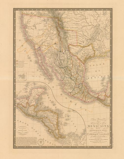
Subject: Southwest United States, Texas & Mexico

Period: 1840 (dated)

Publication: Atlas Universel de Geographie Physique, Politique et Historique…

Color: Hand Color

Size:
14.3 x 20.3 inches
36.3 x 51.6 cm
Download High Resolution Image
(or just click on image to launch the Zoom viewer)

Handsome and uncommon map that details the independent Republic of Texas, the Southwest United States and Mexico. The lower left quadrant is filled with a large inset with Central America shown on the same scale as the main map. The title contains one of the few direct references to the Republic of Texas. Excellent detail throughout. With Brue's embossed seal and surrounded by a decorative keyboard-style border that indicates longitude from Paris. Fancy title lettering embellished with flourishes.

References:

Condition: B+

This example is fine less areas of light offsetting visible in the blank Pacific .

Estimate: $350 - $450

Sold for: $325

Closed on 12/1/2010

Archived