Catalog Archive
Auction 134, Lot 266

"Plan of the City of New York, with the recent and intended Improvements. Drawn from actual Survey by William Bridges, City Surveyor", Bridges, William

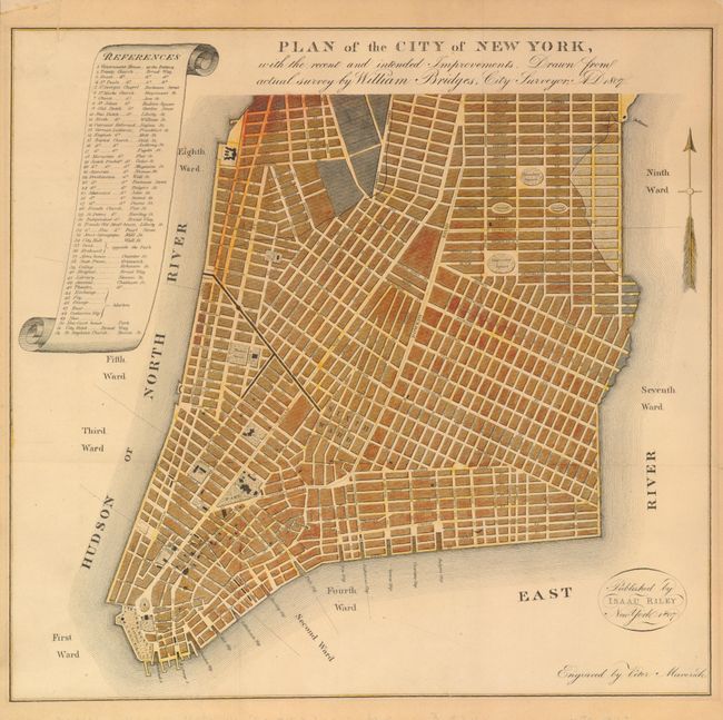
Subject: New York City

Period: 1807 (published)

Publication: Picture of New York

Color: Hand Color

Size:
12.8 x 12.2 inches
32.5 x 31 cm
Download High Resolution Image
(or just click on image to launch the Zoom viewer)

This is William Bridges’ version of the failed 1801 Mangin-Goerck plan. The Common Council of New York commissioned Mangin, a French architect, and Goerck, a well-established New York Surveyor, to prepare a new plan of the city for regulatory purposes. Goerck passed away before the project was completed, giving Mangin full reign to create the plan in his own vision. The resulting map shows Manhattan with bizarre straight shorelines on the south and east, non-existent streets created out of thin air, such as Mangin and Goerck, and showed dry land and streets from areas well into the East River. The Mangin-Goerck plan was immediately rejected by the Common Council and is very rare today.

The plan is finely engraved with all streets named up the so-called Bank and Spruce streets. Locates the Sixth Ward, Hamilton Square and more. At the left is a large legend locating 52 important places and buildings within a scroll cartouche. Considering its imaginary nature and failure as a map, it is curious that Bridges chose the Mangin-Goerck plan as the base for this 1807 map. The map was engraved by Peter Maverick and published by Isaac Riley New York, 1807. Samuel Mitchell needed a map to illustrate his Picture of New York, a travel guide intended for the tourist, and approached Bridges to produce the map. Bridges was the City Surveyor who, in 1811, is best know for laying out New York’s grid street structure.

This map was issued folding in the travel book and also as linen backed with wooden rollers. This example is from the book, with two vertical and horizontal folds, but at some point was mounted on linen. An identical map was published in 1870 in the Manual of the Corporation of New York by John Hardy, Clerk of the Common Council. This edition was folded only once horizontally and vertically to fit into the larger 1870 manual.

References: Augustyn & Cohen pp. 98-99.

Condition: A

Issued folding, now flattened and mounted on linen. Light and even age toning. Very nice impression and full margins. The linen has several small areas of discoloration, that do not bleed-through to the map, apparently from old framing.

Estimate: $1,200 - $1,600

Sold for: $900

Closed on 12/1/2010

Archived