Catalog Archive
Auction 134, Lot 126

"Pas-caerte van Terra Nova, Nova Francia, Nieuw Engeland en de Grote Rivier van Canada", Loon, Jan van

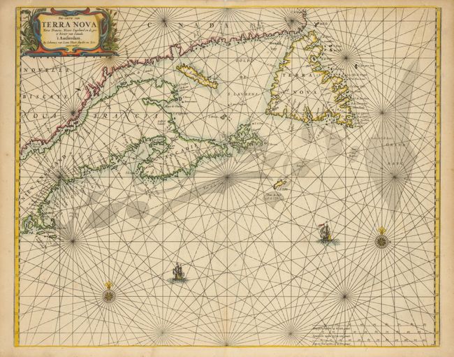
Subject: Canadian Maritimes and New England

Period: 1666 (published)

Publication: Klaer Lichtende Noort-Ster ofte Zee Atlas

Color: Hand Color

Size:
21.2 x 17 inches
53.8 x 43.2 cm
Download High Resolution Image
(or just click on image to launch the Zoom viewer)

This rare chart covers from Rhode Island and Martha's Vineyard to Newfoundland and is the first Dutch sea chart of the Canadian Maritimes. It is based on the work of several important sources including Blaeu, Champlain, Sanson and the manuscripts of Gerritsz. It is notable that Van Loon chose not to show the English settlements in Newfoundland, particularly on the Avalon peninsula, even though that information was used by Blaeu. Prince Edward Island is noticeably missing and the Grand Banks are drawn from Champlain. This important chart became the prototype of the region for the rest of the 17th century. Second state with Gieles van Loon removed from the imprint.

References: Burden #365; Kershaw #179; McCorkle #661.3.

Condition: A

Sharp impression and good margins. There is slight toning and a few tiny spots, but overall very good condition. Remnants of framing hinges on verso.

Estimate: $5,000 - $6,000

Unsold

Closed on 12/1/2010

Archived