Catalog Archive
Auction 134, Lot 125

"East Canada and New Brunswick", Tallis, John
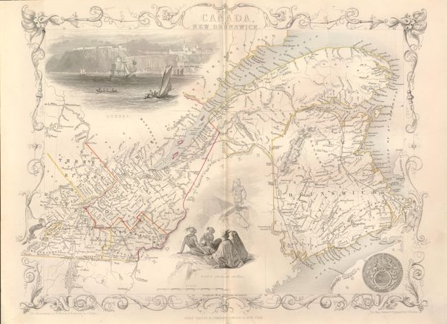
Subject: Canada

Period: 1850 (circa)

Publication:

Color: Hand Color

Size:
13.5 x 10 inches
34.3 x 25.4 cm
Download High Resolution Image
(or just click on image to launch the Zoom viewer)

Lovely nineteenth century map of the St. Lawrence River and New Brunswick. Locates Montreal and Quebec with a beautiful vignette of Quebec as seen from the river. The view of Quebec contains numerous sailing ships and boats in the foreground with the cliffs and settlement high above the cliffs. A second vignette shows a group of North American Indians in ceremonial dress with weapons. Further embellished with the seal of Great Britain and a decorative border. Lovely color in the border, water and views distinguish this exquisite map. Vignettes drawn by H. Warren and engraved by J.B. Allen. J. Rapkin created and engraved the map.

References: Rumsey #2531.

Condition: B+

Vignettes and border left uncolored as issued. This map is often found with trim into the border, this example has good margins outside of border.

Estimate: $140 - $180

Sold for: $110

Closed on 12/1/2010

Archived