Catalog Archive
Auction 134, Lot 123

"[Lot of 2] Amer. Sep No. 2 Decouvertes Boreales [and] Amer. Sep. No. 1 Iles George", Vandermaelen, Philippe Marie Guillaume

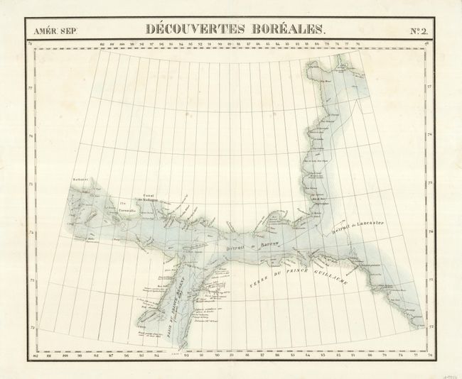
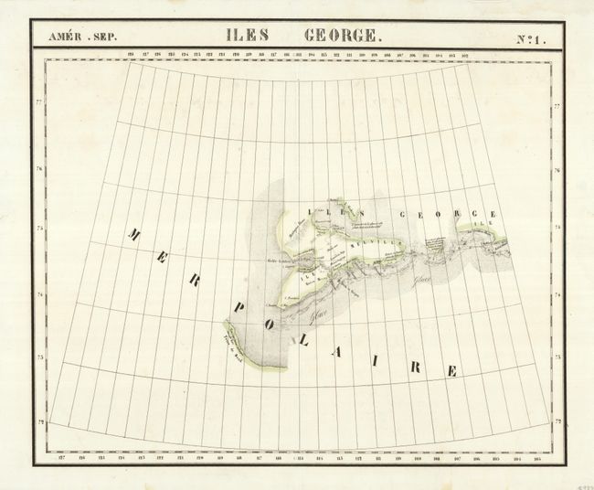
Subject: Canadian Arctic

Period: 1827 (published)

Publication: Atlas Universel

Color: Hand Color

Size:
22.8 x 19.2 inches
57.9 x 48.8 cm
Download High Resolution Image
(or just click on image to launch the Zoom viewer)

Vandermaelen was the son of a wealthy industrialist who abandoned his father's business to follow a career in cartography. His goal was to produce the first atlas ever published in which every map was drawn on the same projection and to the same scale (1: 1,641,836), with each map covering an area of approximately 20 degrees of longitude (from Paris) and 6 degrees of latitude. Because of the consistent scale and projection, the maps could be joined together to form a huge globe that would measure over 25 feet in diameter. Vandermaelen had the only known globe constructed from his maps, requiring a special room for its display. It was also the first lithographic atlas ever published. There was one edition of the atlas, published in 1825-27, and the subscription list shows that only 810 copies were sold. Koeman called his Atlas Universel, "One of the most remarkable world atlases ever made. Far ahead of its time."

These two maps covers parts of the Arctic including the recent discoveries in Baffin Bay, Barrow Strait, Prince Regent Inlet and Melville Island. When these maps were published this region was still at the heart of the search for a viable Northwest Passage to the orient.

References:

Condition: B+

There are some faint spots in the maps with some repaired tears in the blank margins.

Estimate: $180 - $230

Sold for: $130

Closed on 12/1/2010

Archived