Catalog Archive
Auction 133, Lot 538

"A Map of the Mediterranean Sea with the Adjacent Regions and Seas in Europe, Asia and Africa", Faden, William

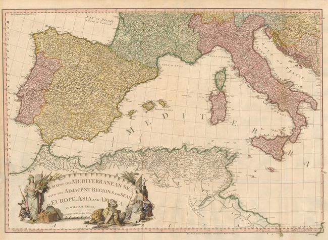
Subject: Western Mediterranean

Period: 1785 (dated)

Publication:

Color: Hand Color

Size:
33.5 x 23.5 inches
85.1 x 59.7 cm
Download High Resolution Image
(or just click on image to launch the Zoom viewer)

The large map covers the western part of the Mediterranean Sea from Spain, Gibraltar and North Africa to Italy, Sicily and Malta. It also provides dense detail through the Iberian peninsula and southern Europe with sparser information in northern Africa. The large ornamental cartouche is flanked by the female representations of Europe and Asia along with a recumbent lion next to a native African figure. This is the western sheet of a 2-part map, but it is complete with the eastern border and thus stands on its own. William Faden was one of England's leading chart makers in the 18th century. His contribution to the development of cartography was considerable, commissioning new surveys and publishing the work of numerous mapmakers throughout Europe.

References:

Condition: B

Professionally backed with Japanese tissue to strengthen the original folds and repair a 4" tear in the cartouche.

Estimate: $400 - $475

Sold for: $300

Closed on 9/1/2010

Archived