Catalog Archive
Auction 133, Lot 168

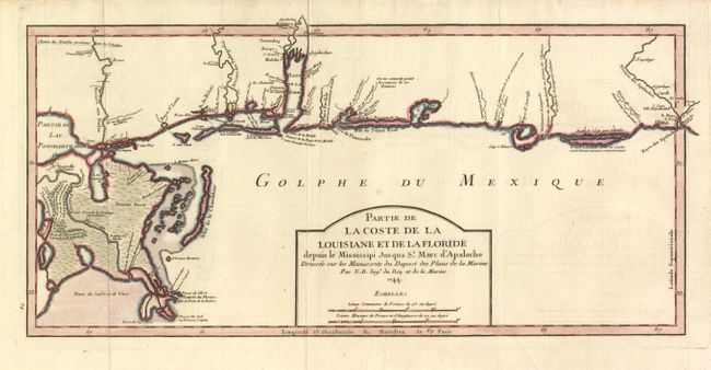
"Partie de la Coste de la Louisiane et de La Floride depuis le Missisippi Jusqua St. Marc d'Apalache", Bellin, Jacques Nicolas

Subject: Colonial South

Period: 1744 (dated)

Publication: Charlevoix's Histoire et description generale de la Nouvelle France

Color: Hand Color

Size:
16.8 x 8.3 inches
42.7 x 21.1 cm
Download High Resolution Image
(or just click on image to launch the Zoom viewer)

This important early chart of the Gulf Coast covers from New Orleans and the Mississippi delta to St. Marks River & Apalachicola Bay. The shoreline is still somewhat speculative but many harbors, inlets, bays & rivers are indicated along the coast. The Mississippi delta is well represented including the English Turn on the Mississippi River (Detour des Anglois). Shown mostly as a vast grassland, two areas noted as forests suitable for lumber are located near the abandoned French Fort de la Boulaye. Numerous Native American tribes and villages are located and the Choctaw road to Natchez is partially shown in the upper left corner of the map. The map was drawn from manuscript sketches brought back to Paris by Pierre Francois Xavier de Charlevoix, a Jesuit Priest who traveled through the region from 1720-1722. Charlevoix's account was extremely influential in future decisions made by Thomas Jefferson with regard to the Louisiana Purchase and the exploration of the west.

References: Tooley (MCC-96) #719.

Condition: A

Despite some very faint offsetting, overall very good with a sharp impression and wide original margins.

Estimate: $600 - $800

Sold for: $850

Closed on 9/1/2010

Archived