Catalog Archive
Auction 132, Lot 659

"Carte Particuliere de l'Egypte, de la Nubie et de l'Abyssinie", Chatelain, Henry Abraham

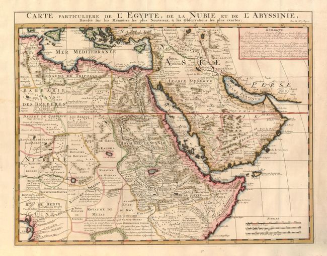
Subject: Northeastern Africa and Arabia

Period: 1719 (circa)

Publication: Atlas Historique…

Color: Hand Color

Size:
20.2 x 15.6 inches
51.3 x 39.6 cm
Download High Resolution Image
(or just click on image to launch the Zoom viewer)

This handsome map is based on the work of the important French cartographer Guillaume Delisle. It is a very detailed and fascinating view of northeastern Africa, the Red Sea and the Arabian Peninsula showing the political divisions and kingdoms. The Blue Nile originates in the mountains near the L. de Dambee in the approximate location of Lake Tana, but there is no sign of Lake Victoria at the head of the White Nile. The desert west of Egypt is filled with comments and little tents and castles distinguish the nomadic tribes versus the permanent settlements. There was increased interest in this region in the early 18th century that coincided with increased commercial activity. By this time European knowledge of the coastlines of the African continent and Arabia had advanced considerably, but the interiors still remained largely speculative.

References:

Condition: A

There is a tiny fold separation at bottom, well away from the map.

Estimate: $350 - $425

Sold for: $250

Closed on 6/2/2010

Archived