Catalog Archive
Auction 132, Lot 522

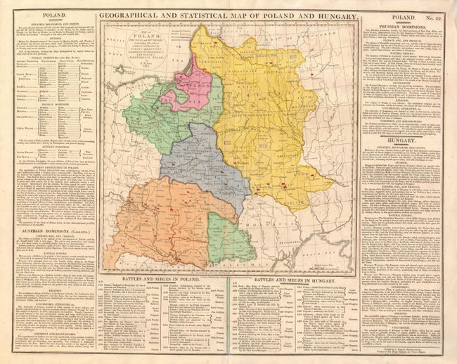
"Geographical and Statistical Map of Poland and Hungary", Lavoisne, C. V.

Subject: Eastern Europe, Poland and Hungary

Period: 1813 (dated)

Publication: Complete genealogical, historical…

Color: Hand Color

Size:
11.8 x 11.6 inches
30 x 29.5 cm
Download High Resolution Image
(or just click on image to launch the Zoom viewer)

This informative map was published in the English edition of Lavoisne historical atlas by John Barfield. It shows the partitions of Poland and numerous battle sites. The map is surrounded on three sides with text describing the history, governments, commerce, climate, agriculture, battles & sieges, etc.

References:

Condition: B+

Original color with minor toning along centerfold and faint offsetting.

Estimate: $100 - $150

Sold for: $60

Closed on 6/2/2010

Archived