Catalog Archive
Auction 132, Lot 418

"The Road from Ferrybridge to Boroughbridge Continued to Barnard Castle…", Ogilby, John
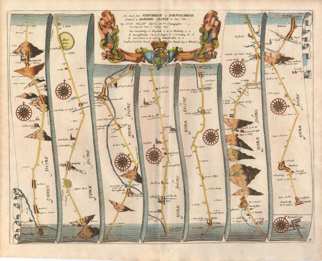
Subject: England

Period: 1675-98 (published)

Publication: Britannia

Color: Hand Color

Size:
17.5 x 13.4 inches
44.5 x 34 cm
Download High Resolution Image
(or just click on image to launch the Zoom viewer)

John Ogilby's 'Britannia' was published between 1675 and 1698. It is a landmark in the mapping of England and Wales. Its unique format constituted the first national road-atlas of any country in Western Europe. It was composed of maps of seventy-three major roads and cross-roads, presented in a continuous strip-form, on a uniform scale of one inch to a mile. Each beautiful map includes wonderful detail of the countryside with each strip containing a large compass rose to indicate changes in direction.

This map covers seventy-six miles of roads in the county Yorkshire, including part of the Great North Road from London to Edinburgh. It passes through several small villages and the towns of Aberford, Ripon, Boroughbridge, and Richmond.

References:

Condition: A+

Nice impression and good margins.

Estimate: $275 - $350

Sold for: $350

Closed on 6/2/2010

Archived