Catalog Archive
Auction 132, Lot 376

"Praefecturae de Paraiba, et Rio Grande", Blaeu, Johannes
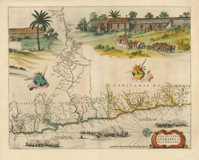
Subject: Brazil

Period: 1662 (circa)

Publication: Atlas Maior

Color: Hand Color

Size:
21 x 16.4 inches
53.3 x 41.7 cm
Download High Resolution Image
(or just click on image to launch the Zoom viewer)

Superb map of the Brazilian coastline including the capitanias of Paraiba and Rio Grande. The map was drawn after actual surveys by Georg Markgraf, Elias Herckmanns and others, and was among the first maps of Brazil based on non-Portuguese data. The map is richly engraved with a huge scene of a procession of Tupinamba Indians carrying a Dutch flag, part of a sugar mill, and three major sea battles depicted in the sea. Further adorned with coats of arms, a compass rose and strapwork title cartouche. The series of maps of the capitanias of Brazil are unlike any other map in Blaeu's atlases. Blaeu first issued this and its companion maps in 1647 for Gaspar Barleus' Rerum per octennium in Brasilia. They were also assembled into a large wall map, Brasilia qua parte paret Belgis; the places where the sheets overlapped are marked by faint lines at left. The maps then appeared in the Atlas Maior beginning in 1662. French text on verso.

References: Goss (Blaeu) pp. 184-185; Whitehead (TMC-40) pp. 17-20.

Condition: A

Superb old color and condition with a minor printer's smudge at upper left.

Estimate: $1,600 - $2,100

Sold for: $2,750

Closed on 6/2/2010

Archived