Catalog Archive
Auction 132, Lot 369

"Venezuela, cum parte Australi novae Andalusiae", Hondius, Henricus
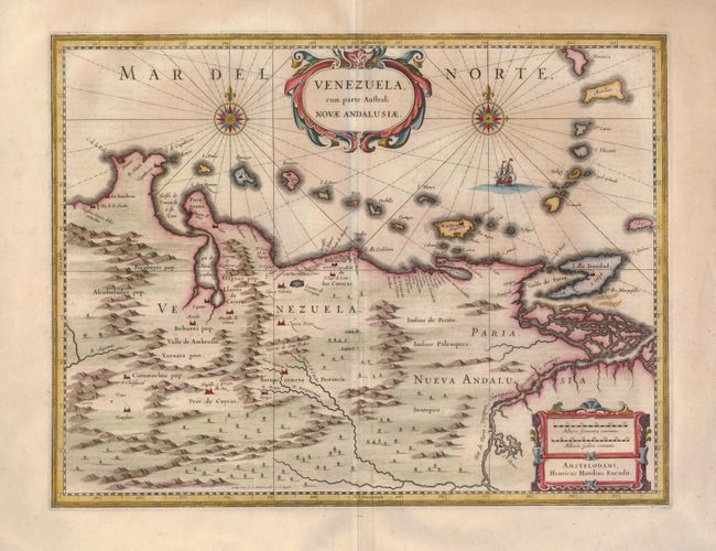
Subject: Venezuela

Period: 1638 (circa)

Publication:

Color: Hand Color

Size:
19.3 x 14.6 inches
49 x 37.1 cm
Download High Resolution Image
(or just click on image to launch the Zoom viewer)

This beautifully engraved map is based on the cartography of Hessel Gerritsz. It covers the northern coast of South America, Venezuela, east to the mouth of the Orinoco, and includes the offshore islands from Aruba through Dominica and Tobago. The fine engraving illustrates the mountains, forests, rivers and missions in the interior, but shows place names primarily along the coastlines owing to the relatively few explorations made into the interior. The map is richly embellished with title and distance scale cartouches, compass roses and a galleon. Engraved by E.S. Hamers-veldt and S. Rogeri. Dutch text on verso.

References:

Condition: A

There is a tiny pinhole in an unengraved part of the map and the centerfold has been professionally repaired in the blank margins.

Estimate: $425 - $500

Sold for: $240

Closed on 6/2/2010

Archived