Catalog Archive
Auction 132, Lot 357
"The Dutch Islands of St. Eustatia, Saba, and St. Martins; The French Island of St. Bartholomew; The English Islands of St. Christophers, Nevis, and Anguilla; with the smaller Islands and Keys adjoining", Lodge, John
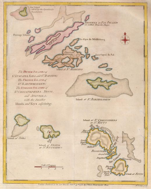
Subject: Lesser Antilles
Period: 1781 (dated)
Publication: Political Magazine
Color: Hand Color
Size:
8.3 x 10.5 inches
21.1 x 26.7 cm
Download High Resolution Image
(or just click on image to launch the Zoom viewer)
(or just click on image to launch the Zoom viewer)