Catalog Archive
Auction 132, Lot 339

"Tabula Geographica Maximae Partis Americae Mediae sive Indiae Occidentalis - Karte des Betraechtlichsten Theils von Mittel - America oder Westindien…", Walch, Johannes
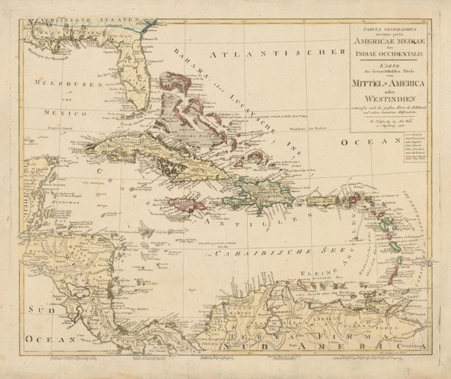
Subject: Caribbean

Period: 1798 (dated)

Publication:

Color: Hand Color

Size:
23.5 x 19.2 inches
59.7 x 48.8 cm
Download High Resolution Image
(or just click on image to launch the Zoom viewer)

This is a very uncommon German map of the West Indies based on the work of Bryan Edwards, a Jamaican planter and British politician. The map extends to cover Florida, Central America and the northern coastline of South America and provides fine detail including the direction of currents. The original color distinguishes the colonial holdings within the region.

References:

Condition: A

There is a soft extraneous fold near center and some minor repaired tears in blank margins, not near the map.

Estimate: $500 - $600

Sold for: $375

Closed on 6/2/2010

Archived