Catalog Archive
Auction 132, Lot 315

"New Map of the Puget Sound Country. Fourth Revised Edition",
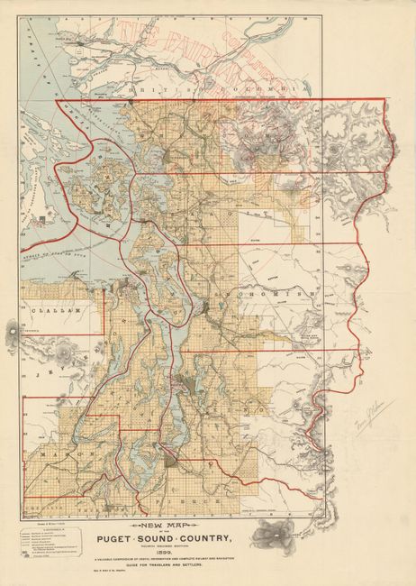
Subject: Washington

Period: 1899 (dated)

Publication:

Color: Printed Color

Size:
22 x 30 inches
55.9 x 76.2 cm
Download High Resolution Image
(or just click on image to launch the Zoom viewer)

This detailed promotional real estate map of the vicinity of Puget Sound is drawn on a scale of 6 miles to the inch. This colorful map extends to Stevens Pass and the Boston Mine in the east, and south to include Olympia and Mt. Rainier, which is drawn outside the map's neatline. A table of references identifies principal cities, county and international boundaries, numerous railways, soundings in fathoms in the harbors, U.S. military naval and lighthouse reserves. Red overprinting shows the distance from Fairhaven in 10 mile increments. Also in red overprinting is "Complements of the Fairhaven Land Co. Fairhaven Washington." Below the title the intended purpose of the map is noted: "A Valuable Compendium of Useful Information and Complete Railway and Navigation Guide for Travellers and Settlers." A remarkable advertising map issued to promote settlement, development and tourism. Fairhaven was founded in the 1880s and was a busy port city by the 1890s. The town has since been absorbed by Bellingham, leaving only a park named after the once thriving port city. A rare advertising issue compiled by Charles H. Baker.

References:

Condition: A+

Folding as issued. Some pencil markings in blank margins, still fine. Remnants of framer's hinges on verso.

Estimate: $600 - $750

Sold for: $550

Closed on 6/2/2010

Archived