Catalog Archive
Auction 132, Lot 29

"Algemeene Kaart van de Ontdekkingen van Kapit. J. Cook…", Cook, James (Capt.)
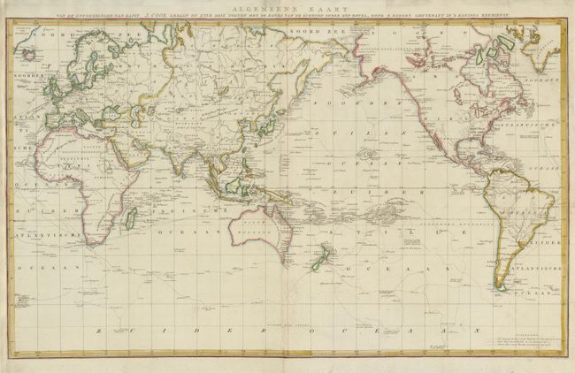
Subject: World

Period: 1784 (circa)

Publication:

Color: Hand Color

Size:
34.8 x 21 inches
88.4 x 53.3 cm
Download High Resolution Image
(or just click on image to launch the Zoom viewer)

This is the uncommon, Dutch version of Cook's large-scale map of the world compiled by Lieut. Henry Roberts from Cook's surveys after the third expedition. The map is presented on Mercator's projection and centered on Australasia and the Pacific. The routes of the Endeavour (1768-71), and Resolution (1772-75 and 1776-80) are traced with occasional notes along the tracks. Lt. Robert's began his compilation under Cook's supervision and completed it after Cook's death. It was used in the official account of the third voyage. Engraved by Baarsel and printed on two joined sheets.

References:

Condition: B+

Issued folded, now flattened with a 5" binding tear at upper right professionally repaired. The left side margin has been expertly extended to better accommodate framing.

Estimate: $900 - $1,000

Sold for: $850

Closed on 6/2/2010

Archived